The best time to visit Death Valley is October to April, when the average high at Furnace Creek is 65 to 93 F. In July the average high is 116 F and the average low is 88 F. We read the NPS pages on 14 October 2026.
Weather by month
Note: All figures come from the NPS Furnace Creek monthly data on its weather page (updated 15 May 2024, read 14 Oct 2026). Furnace Creek is on the valley floor. The mountains in the park are cooler.
| Month | Average high / low (F) | Record high (F) | Average rain (in) | What to expect, our reading |
|---|---|---|---|---|
| January | 67 / 40 | 87 | 0.27 | Cool days, cold nights |
| February | 73 / 46 | 98 | 0.37 | Mild |
| March | 82 / 55 | 103 | 0.22 | Warm. Wildflowers may start late in the month |
| April | 90 / 62 | 113 | 0.12 | Hot by afternoon |
| May | 100 / 73 | 122 | 0.07 | Hot |
| June | 110 / 81 | 129 | 0.03 | Very hot |
| July | 116 / 88 | 134 | 0.11 | Hottest month |
| August | 115 / 86 | 127 | 0.11 | Very hot, late storms can flood |
| September | 106 / 76 | 123 | 0.14 | Still very hot |
| October | 93 / 61 | 113 | 0.10 | Hot days, easing |
| November | 77 / 48 | 97 | 0.17 | Comfortable |
| December | 65 / 38 | 89 | 0.19 | Cool |
NPS lists the yearly average high as 91 F and the yearly rain as 1.94 inches. It says the hottest temperature ever recorded at Furnace Creek was 134 F on 10 July 1913. The page also says "summer temperatures often top 120 F in the shade," with lows in the 90s at night. (The NPS summer heat page says summer nights are often still above 100 F.) It says that thunderstorms, "especially in late summer," can cause flash floods. NPS does not name a best month, so the October to April range is ours. We took it from the highs in the table.
Which month for which plan
Note: NPS FAQ (updated 15 Aug 2026, read 14 Oct 2026): wildflowers may bloom in late March and early April in the low areas, in April and May at mid elevations, and into June in the mountains. The bloom depends on several winter and spring rain storms. Summer hiking is "not recommended except in the early morning hours and in the mountains."
-
Walking at Badwater or the dunes: November to March, our pick, when highs are 65 to 82 F.
-
Wildflowers: late March into June if the winter was wet. NPS says it depends on rain, so we cannot name a week.
-
Summer: possible only as short stops from an air-conditioned car. See the heat rules below.
Heat rules from the Park Service
Note: From the NPS Death Valley summer heat safety page (updated 1 Jul 2026, read 14 Oct 2026). Drink at least one gallon (4 liters) of water a day, and more if you are active. Eat salty food or drink electrolyte drinks. "We do not recommend hiking in the lower elevations in the summer." Heat illness "can be deadly" even when temperatures are in the 80s and 90s F. Summer nights often stay above 100 F, and the coolest time is usually just before sunrise. Stay on paved roads and close to your vehicle. If the car breaks down, stay with it. Carry extra water and tire-changing equipment, because "tow companies can be hours away." Tell someone not on the trip your plan. If you feel dizzy, sick or get a headache, get out of the sun and drink water or a sports drink. Emergency: call 911. The park number is 760-786-3200
Road closures and conditions
Note: NPS road conditions page (road status of 10 Oct 2026 at 4:20 p.m. Pacific, page updated 12 Oct 2026, read 14 Oct 2026). Paved roads closed: Bonnie Clare Road and Scotty's Castle, for flood recovery work, with no access even on foot and no reopening date. Caution: North Highway has loose gravel and missing shoulders from flood damage, and Southern Badwater Road south of Badwater Basin to Shoshone has loose gravel, soft shoulders and large drops at the shoulders. Gravel roads closed to motor vehicles, bikes allowed: Cottonwood and Marble Roads (flooding), Darwin Falls Road ("likely to remain closed until Summer 2027", hikers can park on the CA 190 shoulder and walk in), Hunter Mountain Road (mud) and the one-way part of Titus Canyon Road (repairs, reopening expected May 2027). The two-way west part of Titus Canyon Road, from North Highway to the Fall Canyon Trailhead, closes 27 Oct 2026 through December. Phinney Canyon Road is impassable in its last 3 miles
The page does not list Highway 190, Badwater Road to Badwater Basin, Zabriskie Point or Artists Drive as closed. It does say the park advises you to check the weather before each travel day, because conditions can change quickly. A photo caption on the page ties some damage to flooding on 20 August 2023. We did not check the page again after 14 October.
Some campgrounds are shut on the same page. Texas Springs, Stovepipe Wells and Sunset are closed for the season, and Emigrant is closed for water repairs. Furnace Creek is open.
What to see, with distances from Furnace Creek
Note: Distances and times come from NPS place pages and the NPS FAQ, read 14 Oct 2026. Badwater: 17 miles and 30 minutes south of Furnace Creek (NPS Badwater Basin page, updated 7 Jan 2026), and 18 miles on the FAQ. Zabriskie Point: a 15 minute drive east on Highway 190, then a quarter mile uphill on a paved path (updated 15 Aug 2026). Artists Drive: starts 8.5 miles south of the Badwater Road and CA 190 junction (NPS Artists Drive page, updated 16 Feb 2023). Dante's View: a 45 minute drive from Furnace Creek (updated 11 Jan 2024). Mesquite Flat Sand Dunes: just east of Stovepipe Wells Village off CA-190 (NPS Mesquite Flat Sand Dunes place page, updated 3 Oct 2023, read 15 Oct 2026)
| Stop | From Furnace Creek | What NPS says |
|---|---|---|
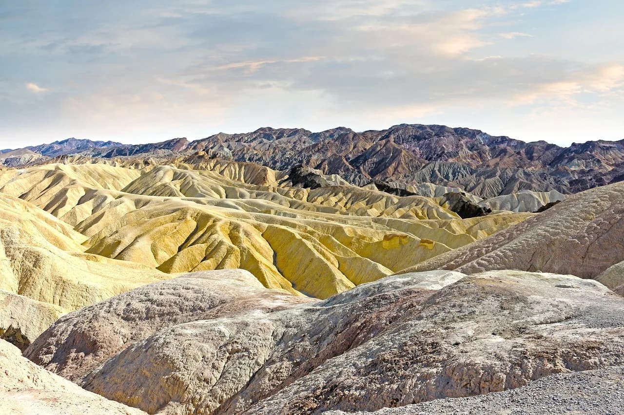
| Zabriskie Point | 15 minute drive east on Highway 190 | Quarter mile paved walk uphill. Manly Beacon rises to 823 ft |
| Badwater Basin | 17 to 18 miles south, about 30 minutes | 282 ft below sea level. 1 mile round trip to the edge of the salt flat, about 40 minutes |
| Artists Drive | Turn off Badwater Road 8.5 miles south of CA 190 | 9 mile one-way paved road. Vehicles over 25 ft are not allowed |
| Dante's View | 45 minute drive | 5,575 ft above Badwater Basin |
| Mesquite Flat Sand Dunes | Near Stovepipe Wells | 2 miles round trip to the tallest dune, 185 ft climb, about 1.5 hours |
NPS calls Badwater Basin the lowest point in North America. For a longer look at the salt shapes, it suggests a 1.5 to 2 mile round trip walk. It says to plan 25 to 45 minutes for Artists Drive. The Badwater page warns: "hiking not advised after 10AM in the summer." The dunes page also says "hiking not advised after 10 AM in the summer." We did not confirm the dunes' distance from Furnace Creek from an official source.
Fees for 2026
Price: Private vehicle $30 for 7 days. Motorcycle $25. On foot or by bike, aged 16 and over, $15. Annual Death Valley pass $55 for US citizens and residents. America the Beautiful: $80 annual for residents, $250 annual for non-residents. NPS lists no extra non-resident entry fee. The last fee-free days of 2026 for US citizens and residents are 27 October and 11 November. Other fees, such as reservation fees, may still apply on those days (NPS fees page, updated 1 Jan 2026, read 14 Oct 2026)
Getting there, gas and water
Note: The NPS FAQ (updated 15 Aug 2026) says the whole trip from Las Vegas is about 120 miles and 2 hours, through Pahrump, Nevada. The NPS lodging page puts Las Vegas about a 2.5 hour drive from the Furnace Creek Visitor Center. From the west it lists Lone Pine at about 1 hour 45 minutes and Ridgecrest at about 2.5 hours. It gives no time from Los Angeles (NPS lodging page, updated 11 May 2026, read 15 Oct 2026)
Note: Gas: the Oasis at Death Valley in Furnace Creek (two grades of gasoline and diesel), Panamint Springs Resort (gasoline and diesel) and Stovepipe Wells Resort (87-octane gasoline, no diesel). The nearest rapid EV chargers listed are in Beatty, Nevada, 43 miles from Furnace Creek (NPS directions page, updated 24 Jan 2025, read 14 Oct 2026)
The NPS safety page (updated 14 Nov 2024, read 14 Oct 2026) says "Water is available at Furnace Creek, Stovepipe Wells, and Panamint Springs." Carry extra water in the car anyway, as the summer page says.
What we checked and what can change
Checked on 14 October 2026: NPS Death Valley pages on weather (updated 15 May 2024), summer heat (1 July 2026), safety (14 November 2024), road conditions (status of 10 October 2026, page updated 12 October), fees (1 January 2026), directions (24 January 2025), the FAQ (15 August 2026), Badwater Basin (7 January 2026), Zabriskie Point (15 August 2026), Artists Drive (16 February 2023) and Dante's View (11 January 2024). Read on 15 October 2026: the NPS Mesquite Flat Sand Dunes place page (updated 3 October 2023) and the NPS lodging page (11 May 2026).
Not confirmed: the dunes' distance from Furnace Creek, the drive time from Los Angeles, current road status after 12 October, gas prices, lodging rates, and whether the wildflowers bloom this year. Temperatures are long-run averages, not forecasts. Road closures change fast after storms, so check the NPS road page the day you go.